Pages

Saturday, May 24, 2014

Cody, WY


web photo


I arrived in Cody on Wednesday, May 14th.  My vacation is over, its back to work for a few months. During the first few days I walked around town and stopped in some of the local coffee shops and diners.  I usually don't eat out, but I wanted a few days of rest after more than a week on the road, so I treated myself to some meals out, people watching and just sitting in a coffee shop reading brochures about the town.

view from the Cody Library Cafe

Everything is Cody is very accessible without a car. I can walk to the grocery store, health food store, Kmart, Walgreen's, the post office and library. I have already signed up for a library card.


Canal Park and walking trail


There are many parks and recreational facilities, I have walked on several of the trails that are in town or along the river. There are many stores selling unique items and souvenirs. And there is a high-end women's clothing resale shoppe, so I may be able to find something to wear for the wedding I am going to in August. There is also a quilt shoppe in town that I want to visit.


Shoshone River Trail


There are perks with a seasonal job. I have been on a free trolley ride ($25 value) and was able to visit the Buffalo Bill Center of the West Museum ($18 value).  I have also been given free admission tickets and some discount coupons for other attractions and will probably be able to do a free rafting trip.


The entire town smells of lilacs as I walk around town. There are purple and white lilac trees and bushes everywhere. All of the houses around town are very cute and well taken care of.  I take a walk once or twice everyday. There is a bike store in town and I need to have a tune-up done on my bike so I can ride around, then I may ride to some of the attractions that are a little bit further down the road.


Monday, May 19, 2014

Wind River Scenic Byway

This post is not in date order

Traveling north from Casper, WY to Cody, WY on Wednesday, May 13, 2014

Near the town of Shoshoni, before you reach Thermopolis, you come upon a huge lake surrounded by beautiful hills and then you drive through the canyons on a gently curving road following the Wind River. This is an awesome drive and I plan to return to this area, to camp, while I am working in Cody.

photo from website www.wyoparks.state.wy.us
The lake is all part of Boysen Lake State Park, there are several campgrounds in the park.

Home to two Indian nations, the Eastern Shoshone and Northern Arapaho, the Wind River Indian Reservation reaches 70 miles east to west and 55 miles north to south. It spreads over 2.2 million acres from Thermopolis on the northeast, to Shoshoni on the east, Lander on the south, and Dubois on the west. The population of the reservation includes 4,500 Arapaho and 2,500 Shoshone.


Before it leaves the canyon, the river changes names. At the “Wedding of the Waters,” the Wind River becomes the Rocky Mountain Bighorn River, named for the mountain sheep indigenous to the area. Keep an eye out for these wooly cliff dwellers as you drive. 1995 saw 43 bighorns “transplanted” along the canyon rim. After making the trip from Dubois, WY in horse trailers, the sheep were then loaded onto flatcars by Burlington-Northern Railroad before traveling the final 7 miles by railroad. They were released in the canyon, bolstering today’s population to an estimated 100 sheep in Wind River Canyon.


Sunday, May 18, 2014

Looking for Grizzlies

I arrived in Cody on the first day of the "Spring into Yellowstone - Birding and Wildlife Festival".
After I received my work schedule, I called to sign up for some tours. I was only able to get on one of the tours. 


FOREST SERVICE WILDLIFE TOUR
Fee: $30/Sat, 5 am – 11 am
This one of a kind tour will involve a scenic drive beginning in Cody and touring along the North Fork Highway to the east entrance of Yellowstone National Park. Wildlife is usually fairly congregated and visible along the North Fork this time of year, as plants are beginning to green-up while adjacent high elevations are still snowbound. To increase the chances of seeing bears, this tour leaves early in the morning when wildlife is most active. In addition to wildlife viewing, participants will experience the spectacular scenery and the unusual rock formations of the North Fork and Shoshone National Forest.


5:00 am - the moon is still out

It is not a good idea to roam around this area alone.  Although I do not mind driving the RV around, sometimes it is not practical or the trail heads do not have the room for an RV.  I plan to sign up for as many hikes as I can and to go on some Ranger led hikes in the park.  I have already made reservations for the Fishing Bridge campground in Yellowstone for some of my days off work.


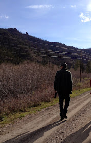
The ranger leading the way - carrying bear spray

On Saturday's hike we did not see any bears, but we saw tracks and scat. 


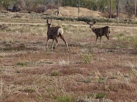
We did see mountain sheep, elk, mule deer and whitetail.  We saw an elder bison sitting in a dust circle and there was a bison walking on the highway in front of the van.  We also saw 2 bald eagles in a tree with a nest.


Yellowstone Country is an awesome place and I haven't even been inside the park yet.


Wednesday, May 14, 2014

Wyoming


Well, I've finally made it into Wyoming and will check into my job on Wednesday,
just 3 1/2 more hours of driving until I reach Cody.

I-25 North from Fort Collins, CO to Cheyenne, WY is a very busy highway, after Cheyenne there is not much traffic and a lot of open space.  I stopped at rest stops to take some pictures of the mountains but did not stop in any towns along the way. I don't like to take pictures while driving, I passed a lot of interesting sites along the way with nowhere to pull over.


The population of the State of Wyoming is 576,412
The least populated state in the U.S.
The population of Chicago is 2,715,000


Tuesday night, I stayed at Fort Caspar Campground in Casper, WY (different spelling for the Fort). I did not arrive early enough to visit the Fort Caspar Museum, which is about 2 blocks from the campground.

Here are a few pictures from the campground.  It is a Passport America park with a lot of full time residents, the park is kept up and clean but not the prettiest park I have stayed at. I did walk along the river trail after getting set up.


North Platte River


part of a dead tree carved into a fish design

link to the Izaak Walton League
defenders of soil, air, woods
waters and wildlife.


link to the Highway Travelers Guide to the
Oregon, California, Mormon Pioneer and Pony Express Trails across Wyoming


Monday, May 12, 2014

Waiting

Tuesday May 12, 2014

Waiting for I-25 to clear up.  WYDOT states "no unnecessary travel" and "black ice" on some of the roadways early this morning. Freezing temps and high winds don't help with the snow removal. I have also checked the webcams for I-25.

I always check the state sites to see if I can sign up for alerts.  So far, I am receiving text alerts from Colorado and Wyoming.  You can set up an account online (free) and choose what type of alerts you want to receive.


Today it is sunny with grey skies in Fort Collins, CO.  I walked around this morning and took a few pictures.  It is not too bad here. No snow on the roadways in the park.


Cleaning the snow off the RV roof
When I emptied my house back in 2011,
I did stow away a long snow brush in the RV - just in case.


I am so glad I purchased a heated water hose
in 2012 before I started my job at Mesa Verde.
I don't have to worry about leaving the faucet running in the RV.
 Or trying to decide if I should unhook the hose.
(Amazon link for heated water hose on sidebar)


We are supposed to have below freezing temps tonight.  It will probably be close to the 11:00 am checkout time before I leave tomorrow, giving the sun time to warm things up. Sunny skies are predicted for tomorrow and I am hoping that the roads will be in better shape. The plan is to drive only 227 miles to Casper, so I do not need to leave at the crack of dawn. 


Saturday, May 10, 2014

Winter Storm Warning

Friday, May 9, 2014 / Saturday May 10, 2014

On Friday morning I drove from La Junta, CO to Fort Collins, CO.  I decided not to drive up I-25, instead I followed some of the lesser used roads. There was very little traffic on these roads and only a few towns. A lot of open space, not many buildings, just a few lonely old windmills.


We had a little bit of rain and wind around 6pm on Friday and the temps are dropping. Saturday morning is sunny and cool - the calm before the storm.

I will be in Fort Collins until Tuesday. Looks like things will be clear and warming up then. Its 435 miles from Fort Collins to Cody, hopefully I will be able to check in to my new job, on time, by Wednesday afternoon.

There was a thought on Saturday morning to drive as far as Casper, WY before the storm hits, but there is a chance of wind and rain along the route. I checked the weather for 5 cities between Fort Collins and Casper and decided to just hang out in Fort Collins until things clear up.


Winter Storm Warning:
A winter storm watch remains in effect from Sunday morning through late Sunday night.
Total snow accumulations... around one foot possible in the southern Laramie range and 6 to 10 inches possible elsewhere in the watch area. Northeast winds 20 to 30 mph. Visibilities may be reduced to a quarter mile in falling and blowing snow. There is a possibility for roads to be closed due to hazardous winter conditions. 


Seems like this road trip had been all about the wind and weather. It has not been all bad, the scenery along the way has been great and most of the time the skies were a beautiful bright blue. I've explored a few small towns and an historical site.  I had a good relaxing day on Thursday and I plan on walking from the RV park to a Nature Trail on Saturday before the weather changes.


"Sit and Reflect"

I am in a beautiful place to sit and wait out the storm.


Friday, May 9, 2014

Bent's Old Fort National Historic Site

Thursday - May 8, 2014

No early start today.
The weather is nice in SE Colorado, why not just stay around here.

I was getting tired of looking at weather reports,
 checking maps and worrying about which way to go.
I didn't want to rush around - trying to outrun the weather again.
What's the rush.
I have plenty of time to make it to Cody by May 14th.
 I still have 6 more days to drive 650 miles.

This map shows that most of Colorado and Wyoming
will have rain or storms or light snow on Thursday.


Today I visited Bent's Old Fort near La Junta, CO and drove a total of 66 miles.

The Spirit of a Place
From the fort's Council Room to the tepees on the plains, peace was pursued as good business practice. Even the fort's plaza, functioned not only as a center of trade, but as the center of a diverse frontier community. When the Cheyenne danced, with onlookers encircling the plaza, it became a spiritual center.

Peace, Serenity & Wealth
At Bent's Fort everyone worked to keep the fort running and make it successful as a commercial enterprise. For some the fort was home, for others it was a welcome respite from the rigors of the Santa Fe Trail.  After enduring trail hardships, visitors came face-to-face with a fort brimming with the trappings of society. Tables, chairs, tablecloths, plates, silverware, chandeliers, glass window panels, musical instruments, billiards, plentiful dry goods and liquor - each item was calculated to impress, each element set Bent, St. Vrain & Company apart.  With all the gambling, dancing and toasting, Theodore Davis wrote that Bent's Fort was "the very merriest of all the trading posts on the frontier".


Visitors can hike a mile and a half trail that winds its way through the cottonwood trees alongside the Arkansas River. The marsh is home to several species of birds.


Looks like a beautiful day to be outside.

The weather was so nice at the fort that I programmed my GPS for an RV park 2 hours north.  I drove away from the fort and when I made a turn, I was confronted with big dark skies and decided not to continue north. In just a few minutes I was at an RV park in La Junta, CO. The thunder and rain started soon after I pulled into the RV park.

The weather looks good for traveling Friday morning, with more rain Friday evening and into Saturday. I will probably head north and drive a few hours on Friday morning.  Not to sure when I will make it into Wyoming. 

Thursday, May 8, 2014

Dalhart, TX and Lamar, CO

Wednesday - May 7, 2014


It was an early start again on Wednesday. I left the RV park at 7am. High winds were predicted to start at 11am.

From the weather report in Amarillo:
Blowing dust advisory until 10 pm.  Southwest winds of 35 to 39 mph with higher gusts are expected across the Oklahoma and Texas panhandle. The wind will start around 11 am CDT. Sustained winds of 35 mph are expected, blowing dust could restrict visibility.

Luckily, I had a tail wind today, I felt the wind a few times when the road turned E-W for a short time, but I was heading straight north to Colorado, and did not have any problems.


I stopped at the XIT Museum in Dalhart, TX. They did not open until 9am, I arrived early and had to wait so I did not spend a lot of time in the museum. Admission is free, but they ask for donations. I would stop by this town again if going in that direction. I found out that you can dry camp in the church parking lot, just down the street from the museum or at the Senior Center a few blocks away.


The XIT ranch in the 1880's was the largest range in the world under fence, and it all laid in the Texas Panhandle. Its three million acres sprawled from the old Yellow House headquarters, near what is now Lubbock, Texas northward to the Oklahoma Panhandle, in an irregular strip that was roughly 30 miles wide.

In 1881, the State of Texas struck a bargain with Charles B and John V Farwell, brothers in Chicago, under which the brothers agreed to build the $3,000,000 pink granite state capitol in Austin and accept the 3,000,000 acres in payment.  In 1895 the first cattle, long of leg and long of horn, rolled onto the XIT. The XIT brand was originated to thwart rustlers as it was hard to alter.

The ranch ceased operation in 1912 with the last of its land sold in 1963.

There is a lot of interesting information about this huge operation at the museum and on the website.


Providing water for 150,000 cattle on 3,000,000 acres proved challenging, especially during the first years of the operation of the XIT Ranch.  The Canadian River - the only major source of water that crosses the Texas Panhandle - passed through the center of the ranch and a few springs provided some water.  During rainy years, playa lakes furnished water on part of the ranch.  Eventually, more than 300 wells and windmills supplied most of the water consumed by livestock as well as humans on the XIT.


After leaving the museum, I only stopped a few times to take pictures at roadside stops. I noticed on my maps that I would be traveling through the Rita Blanca National Grassland and Comanche National Grassland. At an intersection in the town of Campos there are signs pointing east to go to a prairie chicken viewing area or west to go to the Picture Canyon.  I knew these would not be short detours. I decided it was best to do some research, find some camping places nearby and stop at these places on a different time through this area. 


I ended the day in Lamar, CO - went to the Visitors Center at the train depot - checked out a used bookstore and had lunch in a coffee shop.


Checked into the Country Acres (Passport America) Motel & RV Park. The park is very well taken care of and landscaped nicely, the sites are gravel and set up kind of strange, pull through, but more like parallel parking. The wind started to get really strong about 1/2 hour after I arrived, so I moved to a site that would be sheltered by the building. 


Miles driven Wednesday.....233

Fuel prices (mid grade):
Dalhart, TX    $3.639
Lamar, CO      3.669