Remember that when you leave this Earth, you can take with you nothing that you have received, only what you have given, a full heart enriched by honest service, love, sacrifice and courage. -St. Francis of Assisi

Wednesday, September 24, 2014

Grand Canyon Trivia

Grand Canyon National Park
Arizona

The Grand Canyon became a National Monument January 11, 1908
and was designated a National Park February 26, 1919.


One of the 7 Natural Wonders of the World


The Grand Canyon
has 277 miles of river
and
1.2 million acres of land.


From Rim to Rim
the average width is 10 miles
expanding 18 miles at its maximum
and shrinking down to
600 feet at its minimum

Driving from the North Rim
to the South Rim - 210 miles -
will take about 5 hours.

Hiking Rim2Rim is about 21 miles
and may take 2-3 days


Used for strength and stability, beginning in the 1920's,
mules have carried visitors
 from around the world down the canyon trails.

The mule is a cross between
a donkey stallion and a horse mare.
Mule Guide on the Uncle Jim Trail

Monday, September 22, 2014

Bryce Canyon National Park

September 17-18, 2014   -   A mini-vacation from workamping.

"Hoo-doo" -  rock formations at Bryce Canyon

It was time to take the RV for a drive, I have been parked in one spot for a month. I saw a reminder post on Facebook about making sure to get all the engine parts moving on the RV at least once a month.

I decided on Bryce because the weather was expected to be cooler than other places around here.

It is a long drive to anywhere from the North Rim, The drive was about 3 1/2 hours one way.  I decided to stay overnight at Ruby's Inn RV Park right outside of the park. Bryce Canyon NP has a shuttle bus that stops at the RV park and at all of the viewpoints in the park.

I left the North Rim, at first light, at 6:00 am (7:00 am in Utah) and with stopping for gas and groceries, it was around noon by the time I had my house setup at the RV park.  Not the best time of day to start a hike into the canyon, but there was a possibility of rain later in the day and the next day, so I decided to go ahead and hike anyway.

A beautiful day except for about 10 minutes of rain in the late afternoon

After checking all of the information online and talking with my co-workers, I decided to hike the Navajo Trail going down into the canyon. the park service suggests walking the trail clockwise and then you will walk up into "Wall Street" at the end of the hike. Wall Street is like a slot canyon and then you go up more switchbacks back to the rim.

Wall Street

When I finished this hike, I took the shuttle bus to the Visitors Center to check things out and then sat outside to eat a lunch that I packed.  I did not go into the Lodge or the General Store because of the limited time I had on this short trip.


After lunch, I hiked some of the rim trail which is about 5 1/2 miles one way.  There was a little bit of rain late in the afternoon, so I took the shuttle bus between some of the viewpoints.


rain/rainbow at "Bryce Point"


Here is a picture of my late husband from May 2009 at Inspiration Point, he was standing very close to the edge and asked me to take his picture.  He wanted me to stand on the edge for a picture, but I would not do it. He said, "If you are not living on the edge, you are taking up too much space".
May 2009 "Inspiration Point" 

Now, I get close to the edge all the time while hiking, I don't seem to have the fears that I had in the past.  I tried to take a "selfie" at Inspiration Point but the pics did not turn out good.  I need to get an extension for my iPhone so I can take "selfies" while hiking.


Inspiration Point 9-17-2014


Friday, September 5, 2014

Touring with Ranger Gaelyn

Thursday, September 4, 2014


For several years, I have been corresponding with Gaelyn through our blogs. We both grew up in the Chicago area and both enjoyed spending time at Starved Rock State Park, so we have some things in common.

This is Gaelyn's 8th season as a ranger on the North Rim, she has been a seasonal park ranger for more than 20 years.

I arrived on the Kaibab Plateau on Thursday, August 15th and by coincidence met with Gaelyn in the parking lot at Jacob's Lake.  We both have Thursday off work and planned to get together today after the morning rains stopped.


We had a great afternoon exploring the Walhalla Plateau area of the North Rim.

Point Imperial,  Roosevelt Point, Cape Royal and Angel's Window

Lupine
We stopped along the side of the road to take pictures.


We spent a lot of time at the various overlooks, waiting for the light to change
and to watch the approaching storm, it was time to leave when we heard
the thunder and were losing daylight.


 I would love to explore inside this canyon.
 I'm hoping to go about a mile into the canyon before I leave here,
 and I will return another year to travel deeper into the canyon.


I am still learning the names of the rock formations, so I have not labeled these pictures.


If you want to see some great photos check out Gaelyn's blog - 

or check out her Facebook page https://www.facebook.com/Geogpsy


It is now after 9pm and I am listening to the wind and the rain as I write this. We had just a few hours without rain today to explore this area of the park and were not able to explore all of the trails and the ancient pueblo sites, but we did see the sky changing color as the sun started to set.


Drake Tax Software

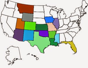
Overnight stays in these states:

Overnight stays in these states:
It is the sandstorm that shape the stone statues of the Desert. It is the struggles of Life that form a person's character ~ Native American Proverb